earth_to_signal
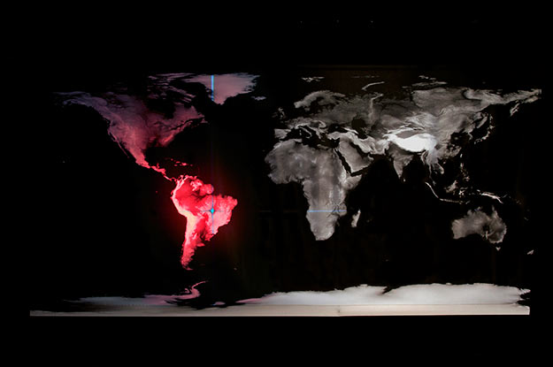
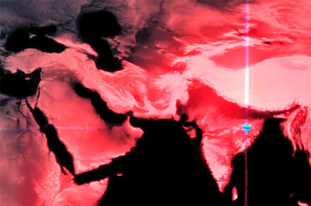
installation 2011 [BY ART OF FAILURE]print on textile and light pointer
- EARTH_TO_SIGNAL propose une cartographie terrestre légèrement différente des projections habituelles : celle-ci représente les niveaux d'altitude de la planète transcrits en niveaux de gris. Ce planisphère s'affranchit des analyses climatologiques et des considérations administratives ou politiques pour présenter la topographie terrestre de manière brute et continue. Dans l'obscurité, un pointeur lumineux parcourt cette carte et transforme les informations d’altitude en vibrations audibles. Ce mécanisme ne laisse entrevoir la carte terrestre que par fragments, tout en plongeant l'auditeur dans une lecture sonore de la surface du globe.
- Earth_To_Signal proposes a slightly different cartography than the usual projections: it shows the reliefs of the planet translated into grey scales. This planisphere is free from the climatological, administrative or political considerations, it presents the earth topography in a raw and continuous manner. In a pitch black room, a laser pointer travels all over the map, translating the topographic variations into audible vibrations. This mechanism only let us see the terrestrial map by fragments, while immersing the listener in a sonic perception of the earth surface.